ALL PROJECTS

BELL’S POND CONSERVATION PROPERTY · SPRING 2026

Finding
common ground.

A shared landscape plan for conservation, affordable housing, and public access in Greenport and Livingston, New York.

Explore the design
Collaborative Design for the Columbia Land Conservancy

143 ACRES / ONE CONNECTED LANDSCAPE

Bring different needs
into a shared plan.

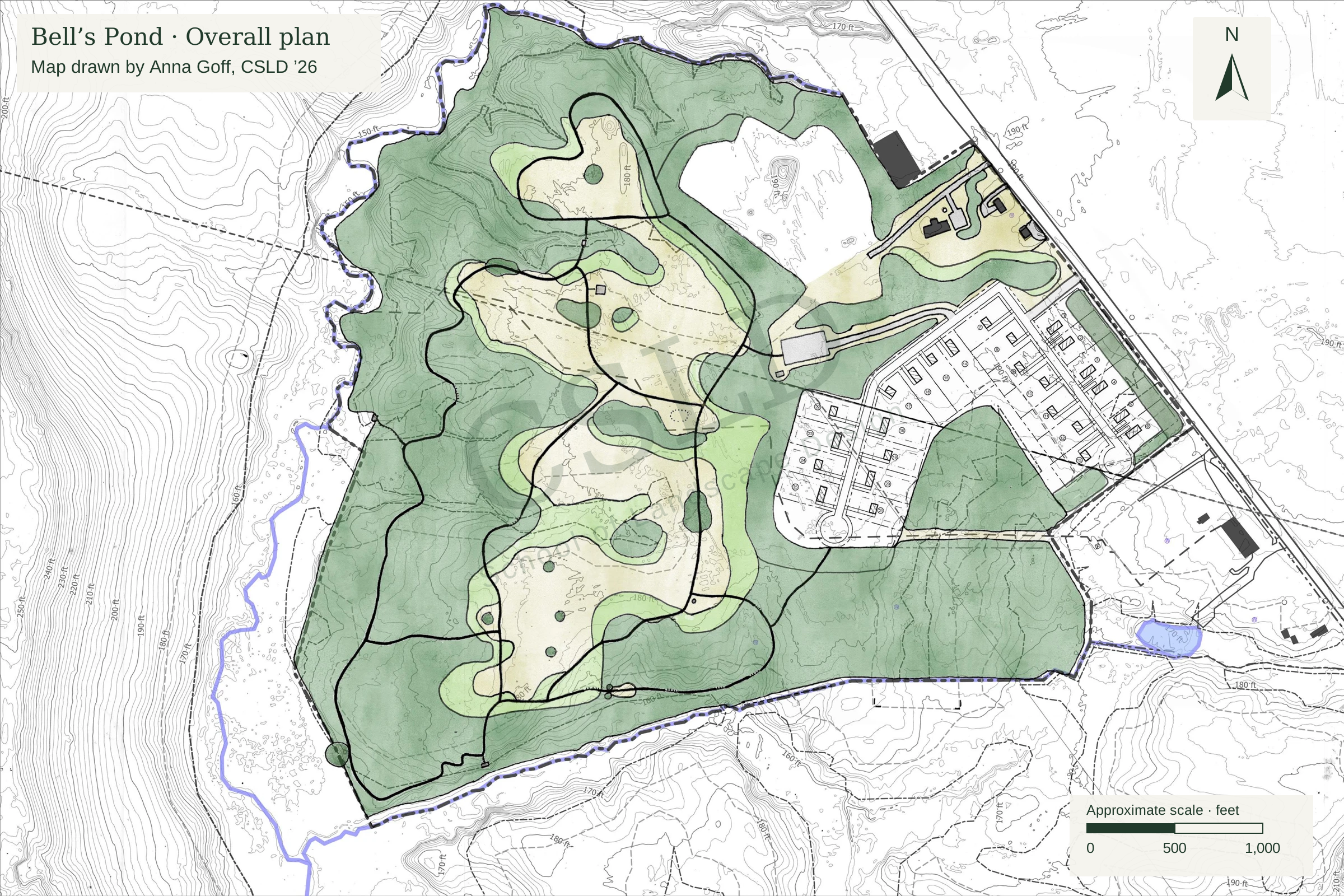
The collaborative project for Columbia Land Conservancy brought together conservation, affordable housing, public access, and community needs across the approximately 143-acre property. Columbia Land Conservancy planned to retain about 110 acres for conservation while transferring portions to Trillium Community Land Trust and Habitat for Humanity for housing.

Investigations of wetlands, hydrology, soils, geology, slopes, vegetation, habitat succession, and circulation informed where housing and trails could connect while protecting sensitive areas. Looking beyond parcel boundaries, the framework treats conservation and affordable housing as complementary parts of a resilient landscape, with shared opportunities for restoration, gathering, and long-term stewardship.

EXPLORE THE DESIGN

One landscape.
Connected experiences.

Select a numbered place or a topic to see the design intention.

Bell’s Pond concept plan with selectable design locations

ARRIVAL + COMMUNITY

Public arrival

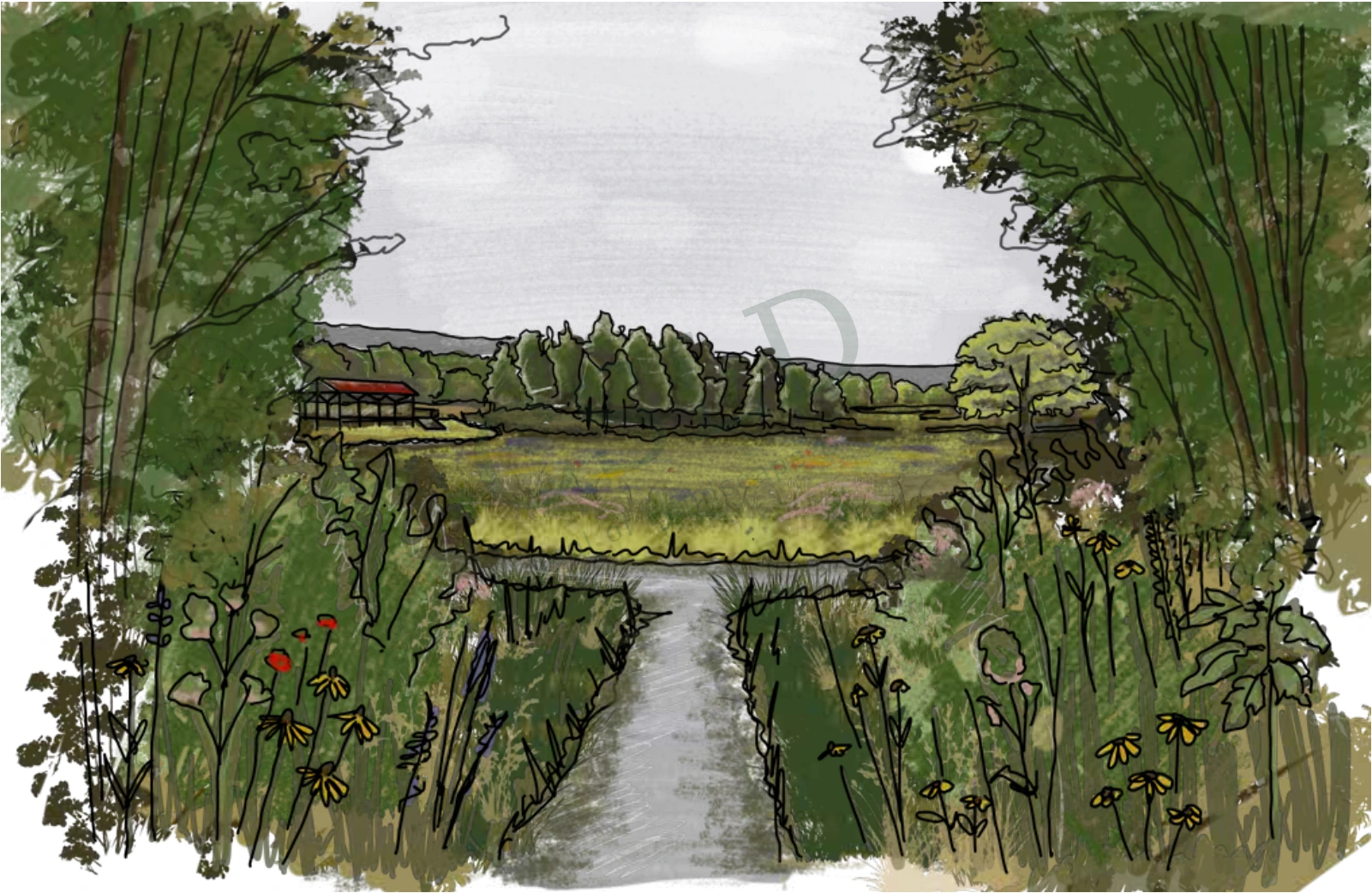
Shaded parking, restrooms, natural play, and a pavilion create a welcoming starting point for the trail network. The pavilion provides a place for educational programming and gathering, connected to the surrounding meadow paths.

View toward the pavilion through the trees and across meadow paths

Concept design · Selected highlights from Finding Common Ground, The Conway School, Spring 2026.

SITE INVESTIGATIONS / HISTORY + CONTEXT

A landscape shaped
by generations of use.

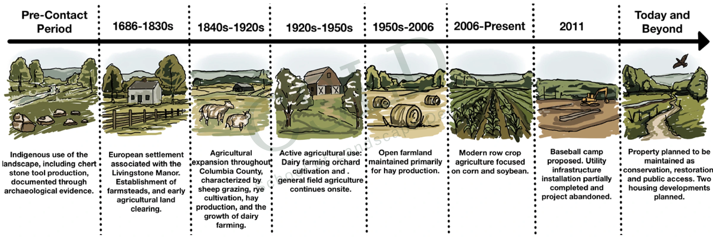
Our investigation traced the site’s history from Indigenous use and stewardship through colonial settlement, farming, orchards, and the unfinished baseball-camp development. The timeline connects these changes with the fields, successional woodland, and infrastructure found on the site today.

Reading that history alongside vegetation, soils, and drainage helped identify opportunities for restoration, reuse of existing infrastructure, and public access. It grounds the design in the landscape’s cultural and ecological context.
Illustrated timeline of Bell’s Pond land use, from the pre-contact period through agriculture, 2011 site work, and future conservation
Site history timeline · Drawn by Zaviere Drumm
Read the landscape before drawing the plan. Design sketch.
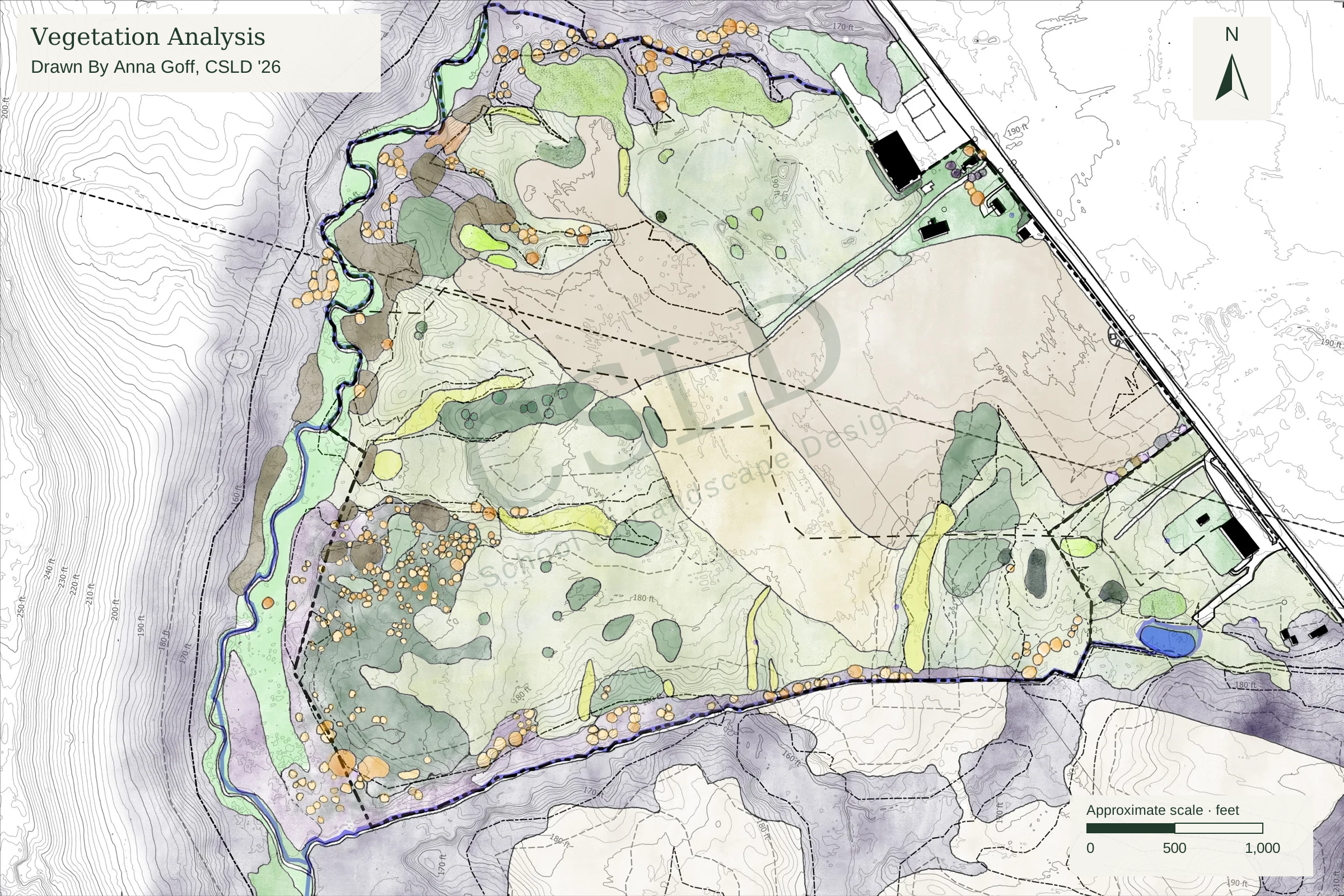
Vegetation Analysis Drawn By Anna Goff, CSLD ’26
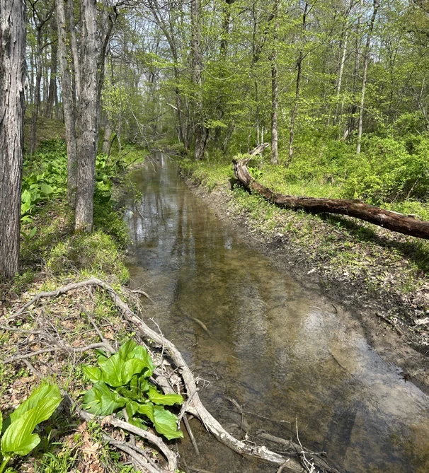
Creek + floodplain at Bell’s PondCreek + floodplain
Successional woodland at Bell’s PondSuccessional woodland
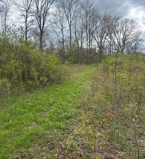
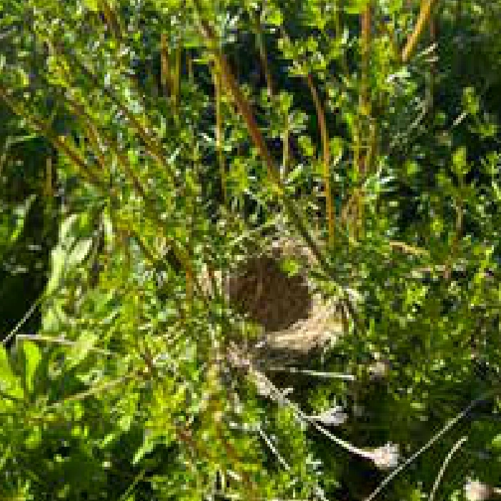
Grassland habitat at Bell’s PondGrassland habitat

01 / SITE ANALYSIS

Read the landscape before drawing the plan.

Mapping existing vegetation reveals the relationship between successional woodland, open fields, wetlands, and disturbed ground. These patterns guide where restoration and access can work together.

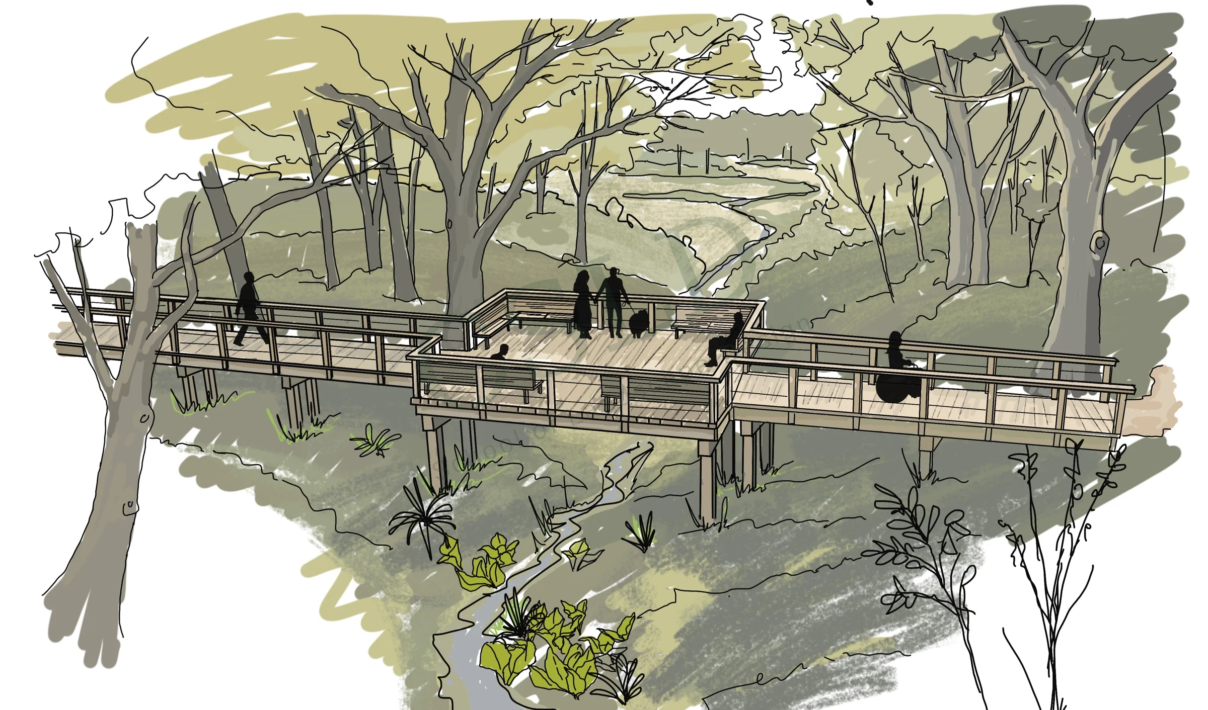
A crossing becomes a place to pause. Design sketch.
Bridge and observation deck · Drawn by Zaviere Drumm

02 / TRAIL + STRUCTURE DESIGN

A crossing becomes a place to pause.

The bridge and observation deck brings visitors closer to the creek through a crossing designed for accessible circulation. Fixed seating and spaces for mobility devices invite people to pause together, while the defined route limits disturbance to sensitive ground.

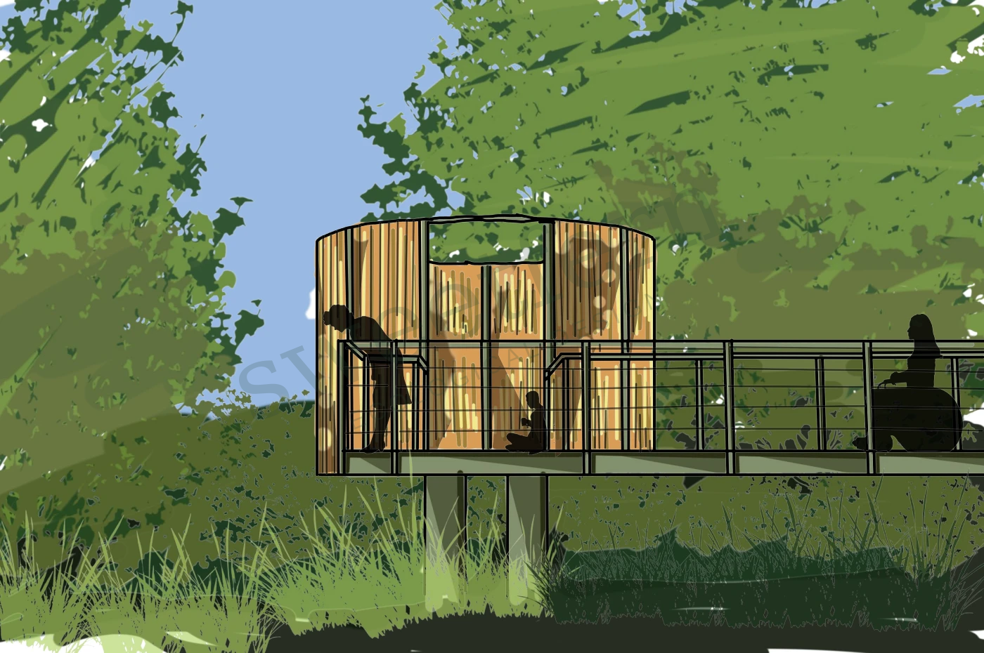
A quieter way to encounter wildlife. Design sketch.
Bird observation blind · Drawn by Zaviere Drumm

03 / HABITAT + HUMAN EXPERIENCE

A quieter way to encounter wildlife.

An elevated approach and screened observation space give the trail a destination. The sketch studies how a small structure can frame views and concentrate visitor activity at the habitat edge.

FROM SITE READING TO DESIGN

Ecology, access, and form.

The selected work shows how analysis can shape an overall plan, and how focused sketches can test the details that make a landscape useful and memorable.